
Flood Risk Assessment Requirements: A UK Planning Guide
An FRA is mandatory the moment your development hits any of these statutory triggers: Flood Zones 2, 3, or 3b; Flood Zone 1 with a site area of 1 hectare or more; or any site flagged by your LPA’s SFRA or the Flood Map for Planning as carrying a future risk. Critical drainage problem areas, proximity to a main river, and certain change-of-use applications can also trigger the requirement. Submit a planning application without one when it’s needed, and the LPA has valid grounds to refuse or invalidate it outright.
Three immediate actions before you do anything else:
- Check the Environment Agency Flood Map for Planning to confirm your site’s flood zone and download a printable flood map for your application.
- Consult your LPA and review their Strategic Flood Risk Assessment (SFRA) - and for major development, contact the Lead Local Flood Authority (LLFA) as a statutory consultee.
- Decide whether to commission a qualified flood risk specialist or prepare a simple FRA statement yourself - the right call depends on site complexity, zone, and development type.
Table of Contents
- What are the flood risk assessment requirements for planning?
- What should a compliant FRA include?
- When do you need a sustainable drainage strategy?
- When do the Sequential and Exception Tests apply?
- Where do you get flood risk data for an FRA?
- Who should prepare an FRA, and what credentials matter?
- What happens when an FRA is missing or inadequate?
- How long does an FRA take, and what does it cost?
- How Clockfortress supports compliant flood risk assessments
- Key Takeaways
- The part most applicants get wrong
- Get a fixed-fee FRA quote from Clockfortress
- Useful sources
What are the flood risk assessment requirements for planning?
Flood risk assessment requirements are set by the National Planning Policy Framework (NPPF), Planning Practice Guidance, and Environment Agency standing advice. The triggers are specific and non-negotiable:
- Flood Zone 2 or 3 (any development). Any proposed development in these zones requires an FRA, regardless of site size or development type. Zone 3b (functional floodplain) carries the most restrictive policy and limits development to water-compatible uses and essential infrastructure only.
- Flood Zone 1 with a site area of 1 hectare or more. The 1-hectare threshold is a hard trigger. A new housing estate on a greenfield site in Zone 1 still needs a full FRA even if the EA flood map shows low risk.
- Sites in areas with critical drainage problems. If your LPA has identified the area as having surface water drainage issues, an FRA is required regardless of flood zone.
- Sites where the LPA SFRA or Flood Map for Planning shows future risk. SFRAs often identify Zone 1 sites that will migrate to Zone 2 or 3 under climate change projections. Check the SFRA before assuming Zone 1 means no FRA.
- Proximity to a main river (within 20 metres). Even in Zone 1, development within 20 metres of a main river typically requires an FRA and may need a separate Environment Agency permit.
- Change of use and prior approval applications. Converting a commercial building to residential in Zone 2 or 3 triggers FRA requirements because residential use is classified as more vulnerable than many commercial uses.
A quick example: a single-storey rear extension to a house in Flood Zone 2 needs an FRA, but it can often be a short, proportionate document following EA standing advice. A new housing scheme in Flood Zone 1 on a site larger than 1 hectare needs a full site-specific FRA with climate change allowances and SuDS strategy, even though the flood zone itself is low risk.
What should a compliant FRA include?
The level of technical detail must match the site’s risk profile - that’s the principle LPAs apply at validation. A report that’s too thin for a high-risk site is as problematic as one that’s over-engineered for a simple house extension.
Every FRA should contain:
- Site description and context maps: red-line plan, OS base map, flood zone mapping from the Flood Map for Planning, and a description of the site’s topography, drainage catchment, and surrounding land use.
- Vulnerability classification: confirm the proposed use against NPPF Annex 3 vulnerability categories (water-compatible, less vulnerable, more vulnerable, highly vulnerable) - this determines which zones the development is permitted in and whether the Exception Test applies.
- Sources of flood risk: assess all relevant mechanisms - fluvial (river), tidal, surface water, groundwater, sewer flooding, and reservoir inundation. Missing a source is a common reason for LPA queries.
- Past flooding evidence: historic flood records, EA flood history data, and any known local flooding incidents.
- Estimated flood levels with climate change allowances: design flood levels for the 1% annual probability (1-in-100-year) event plus the appropriate climate change uplift. Climate change allowances must be selected and justified based on the development’s lifetime, vulnerability classification, and the relevant river basin.
- Hazard, depth, and velocity appraisal: for higher-risk sites, this means hydraulic model outputs showing flood extents, depths, and velocities across the site.
- Finished floor levels: standing advice recommends setting finished floor levels a minimum of 600 mm above the estimated flood level, with flood-resistant materials specified up to that level. Justify any deviation from this recommendation explicitly.
- Mitigation and resilience measures: flood resistance (keeping water out) and flood resilience (minimizing damage when water enters) - specify products, construction details, and maintenance responsibilities.
- Safe access and escape: demonstrate that occupants can safely access and leave the site during a design flood event. Where parts of the site are below estimated flood levels, emergency planning arrangements must be documented.
- Residual risk: what happens if flood defenses fail or are overtopped? Describe the residual risk and how the development manages it.
- Surface water management and SuDS summary: link to or summarize the sustainable drainage strategy (covered in the next section).
- Dataset provenance: record which EA products were used, their version and date, and confirm their suitability for the site scale and risk level.
Pro Tip: For basement conversions and lightwells, the FRA must address groundwater as well as surface water - a point that catches many applicants off guard. See flood risk assessments for basement conversions for the specific resilience measures LPAs expect.
When do you need a sustainable drainage strategy?

SuDS are not optional for most new development. National standards for sustainable drainage systems apply where development affects drainage, sits in Flood Zones 2 or 3, or is at risk of surface water flooding. For major development (10 or more dwellings, or commercial floorspace of 1,000 square metres or more), the LLFA is a statutory consultee on surface water drainage.
A compliant sustainable drainage strategy must cover:
- Surface water flow-paths: how runoff moves across the site in normal and extreme events, including exceedance routing for storms that exceed the design standard.
- Attenuation sizing: storage volumes calculated to limit discharge to the pre-development greenfield runoff rate (or the agreed discharge rate with the LLFA).
- Maintenance strategy: who is responsible for maintaining SuDS features, how often, and what the inspection regime looks like. LPAs routinely attach planning conditions requiring a maintenance plan.
- Adoption proposals: confirm whether the LLFA, a management company, or the applicant will adopt and maintain the drainage system long-term.
- Evidence of compliance with national standards: demonstrate that the hierarchy of drainage options has been followed (infiltration first, then attenuation, then controlled discharge).
Pro Tip: Design the SuDS strategy at concept stage, not after the layout is fixed. Retrofitting attenuation into a tight site layout is expensive and often forces redesign. Getting drainage right early also strengthens Sequential Test evidence by showing the site can be made safe.
When do the Sequential and Exception Tests apply?
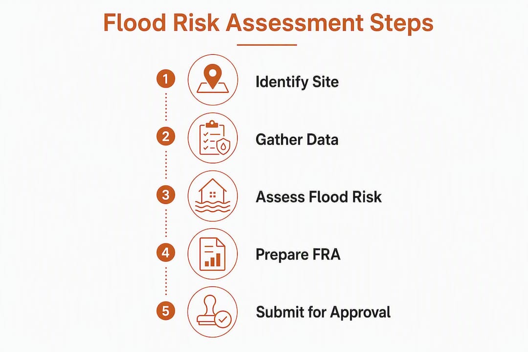
The Sequential Test steers development to the lowest-risk flood zone available; the Exception Test applies when a higher-risk site is genuinely the only viable option and the development delivers wider sustainability benefits. Many applications fail not because the site can’t be made safe, but because the applicant hasn’t properly documented the search for lower-risk alternatives.
Follow these steps to prepare both tests:
- Define your area of search. Set a geographic boundary that’s defensible - typically the local authority area or a functional catchment - and document why it’s appropriate for the development type and scale.
- Compile a site comparison table. List all reasonable alternative sites within the search area, their flood zones, and why each lower-risk option is unavailable (planning constraints, ownership, infrastructure, viability).
- Demonstrate that no lower-risk alternative exists. The LPA will scrutinize this. Vague statements that “no suitable sites were found” are rejected; you need a documented search with dates, sources, and reasoning.
- For the Exception Test (part one): show that the development provides wider sustainability benefits that outweigh flood risk. This is a planning policy judgment, not just an engineering one.
- For the Exception Test (part two): demonstrate through the FRA that the development will be safe for its lifetime, won’t increase flood risk elsewhere, and can be made safe through design and mitigation.
- Prepare the layout and mitigation evidence: show how the site layout, finished floor levels, and SuDS design respond to flood risk and support the Exception Test argument.
For a deeper walkthrough of the evidence structure, the Sequential and Exception Test guide covers template evidence formats and common LPA objections.
Pro Tip: Save dated screenshots of your site search, including the search parameters, results, and any correspondence with agents or landowners. LPAs and Planning Inspectors can and do ask for this audit trail at appeal.
Where do you get flood risk data for an FRA?
The data sources you use must be authoritative and appropriate for the site scale. The EA recommends requesting Product 1 and Product 4 as a minimum, and you must check any model for suitability, scale, climate change assumptions, and currency before relying on it.
Key sources:
- Flood Map for Planning: the starting point for every FRA. Use it to confirm flood zones, download a printable flood map, and request flood risk data for the application.
- EA model products (Product 1 and Product 4): Product 1 provides flood zone outlines; Product 4 provides flood extents, depths, and velocities for specific return periods. Request these directly from the EA - allow several weeks for delivery.
- ‘Check the long-term flood risk for an area’ service: the GOV.UK tool that shows surface water, groundwater, and reservoir flood risk alongside river and sea flooding. Useful for initial screening and for identifying non-fluvial risk sources.
- LPA Strategic Flood Risk Assessment (SFRA): SFRAs identify local future risk, inform Sequential Test application, and set local requirements for site-specific FRAs. Download the SFRA from your LPA’s website or request it directly. Some SFRAs include detailed mapping that supersedes the EA flood map for planning decisions.
- Bespoke hydraulic model outputs: for high-risk sites or where existing EA models lack the resolution needed, commission a bespoke hydraulic model. Factor in 8–16 weeks for modelling and EA review.
Surface water flooding is the source most commonly missed in FRAs - it doesn’t always show on the EA flood zone maps, but it’s a valid ground for LPA objection.
Pro Tip: Record the date, time, and version of every dataset you access. EA flood maps are updated periodically, and an LPA or consultee may challenge data that was current when you accessed it but has since been revised. A timestamped screenshot takes 30 seconds and can save weeks of back-and-forth.
Who should prepare an FRA, and what credentials matter?
For a simple, low-risk house extension in Flood Zone 1 with no surface water issues, EA guidance acknowledges that a homeowner may be able to prepare the FRA themselves using standing advice. For almost everything else, hire a qualified specialist.
Hire a consultant when:
- The site is in Flood Zone 2, 3, or 3b.
- The site is in Flood Zone 1 but meets the 1-hectare threshold.
- The development is new housing, commercial, or mixed-use.
- The site is within 20 metres of a main river.
- Hydraulic modelling is likely (high-hazard sites, bespoke model required).
- The LPA SFRA identifies the site as higher risk than the EA flood map suggests.
When selecting a consultant, check for CIWEM membership or chartered engineer status and ask for examples of FRAs they’ve prepared for similar sites and LPAs. The deliverables you should expect: a site plan, topographic survey, EA dataset review, hydraulic model files (where applicable), a full FRA report mapped to the LPA’s validation checklist, and explicit climate change allowance justification.
Ask at appointment: which EA products will they request, what are their assumptions on climate change uplift, and will they provide draft planning-condition wording? A consultant who can’t answer those questions clearly is not ready for a complex site.
Even for simple projects, run a quick EA flood-map check and LLFA screening before deciding to go DIY. Hidden groundwater or surface water issues can invalidate a standing-advice statement and trigger a full FRA requirement mid-application.
Pro Tip: Request a scoped fee proposal tied explicitly to planning validation requirements - not a generic “flood risk report.” A good brief specifies which EA products will be obtained, whether modelling is in or out of scope, and what happens if the LPA requests additional information.
What happens when an FRA is missing or inadequate?
LPAs check for an FRA during validation and will consult the EA or LLFA depending on site location and vulnerability. A missing FRA can render the application invalid before it’s even registered. An inadequate one typically results in a holding objection from the EA or LLFA, which stalls the application until the report is revised.
Common reasons for refusal or delay:
- Insufficient site-specific data: using national flood zone maps without checking whether a more detailed local model exists.
- Missing climate change allowances: failing to apply the correct uplift for the development’s lifetime and vulnerability classification.
- No SuDS detail: submitting an FRA with no surface water drainage strategy for a site that clearly requires one.
- Absent Sequential or Exception Test: applying for development in Zone 2 or 3 without any documented site search.
- Inadequate access and escape planning: not demonstrating safe access during a design flood event, particularly for more vulnerable uses.
- Poorly justified finished floor levels: setting floor levels without reference to estimated flood levels or the 600 mm freeboard recommendation.
To reduce refusal risk: hold a pre-application meeting with the LPA, submit a complete FRA checklist with the application, consult the LLFA and EA before submission, and use a qualified consultant for anything beyond a simple house extension. Also check early whether works near a main river need a separate Environment Agency permit - planning approval does not replace that consent, and the two processes run on different timescales.
How long does an FRA take, and what does it cost?
Timescales and costs vary significantly with site complexity. The table below gives realistic planning benchmarks - not guarantees, since EA and LLFA response times vary by region and workload.
| Complexity | Typical Timescale | Cost Band | Notes |
|---|---|---|---|
| Simple (standing advice, Zone 1 house extension) | 2–4 weeks | Low (DIY or minimal consultant input) | EA standing advice followed; no modelling required |
| Medium (site-specific FRA, no modelling, Zones 2/3) | 4–8 weeks | Medium (consultant report, basic data) | EA Product 1/4 requested; SFRA reviewed; SuDS strategy included |
| High (hydraulic modelling, multi-consultee, Zone 3/3b) | 8–16+ weeks | High (detailed modelling, EA/LLFA coordination) | Bespoke model commissioned or reviewed; Sequential/Exception Test prepared |
For detailed cost benchmarks by project type, how much a flood risk assessment costs in the UK covers scope examples and what drives fee variation.
Pro Tip: Build contingency into your programme for EA and LLFA consultation windows. Both bodies have statutory response periods, and a request for additional modelling or data can add 4–8 weeks to the process. Starting data requests in parallel with design development, not after planning submission, is the single biggest time-saver on complex sites.
How Clockfortress supports compliant flood risk assessments
Clockfortress (trading as Fortress Associates) prepares planning-ready FRAs for UK developers, architects, and homeowners. The service covers site scoping, EA dataset procurement and review, proportionate FRA drafting, SuDS strategy integration, Sequential and Exception Test preparation, and pre-application liaison with LPA and LLFA consultees.
Every FRA Clockfortress delivers includes:
- A scoped fee proposal tied to planning validation requirements, with a clear deliverable list and timeline.
- EA Product 1 and Product 4 procurement and suitability review.
- Climate change allowance selection and justification documented in the report.
- A planning-condition-ready FRA mapped to the LPA’s validation checklist.
- SuDS strategy integrated into the FRA where required.
- Sequential and Exception Test evidence where the site and zone require it.
Clockfortress operates on a no-advance-payment model: clients review the completed report before paying. Every FRA is validated against current EA and NPPF standards, and the amend-or-refund guarantee means that if a report is rejected, Clockfortress revises it at no additional cost.
Key Takeaways
An FRA is required for any development in Flood Zones 2, 3, or 3b, for Flood Zone 1 sites of 1 hectare or more, and wherever the LPA SFRA or Flood Map for Planning identifies future risk - submitting without one is a valid ground for application refusal.
| Point | Details |
|---|---|
| Know your triggers | Flood Zones 2, 3, 3b, Zone 1 ≥ 1 ha, critical drainage areas, and SFRA-flagged sites all require an FRA. |
| Check data sources early | Use the Flood Map for Planning and your LPA’s SFRA before design is fixed; request EA Product 1 and Product 4 for site-specific work. |
| Match detail to risk | A simple house extension may need only a standing-advice statement; hydraulic modelling is expected for high-hazard sites. |
| Document the Sequential Test | Archive dated search records, site comparison tables, and supporting maps - LPAs and Inspectors will ask for them. |
| Clockfortress delivers planning-ready FRAs | Fixed-fee, no advance payment, with an amend-or-refund guarantee and full EA dataset procurement included. |
The part most applicants get wrong
The most consistent failure pattern in FRA submissions isn’t a technical one. It’s a documentation one. Applicants spend money on a competent hydraulic model, get the flood levels right, specify the correct floor levels, and then submit a Sequential Test that amounts to two paragraphs saying “we looked and there were no better sites.” That’s not evidence. That’s an assertion.
Planning officers and EA consultees are not obliged to take your word for it. The Sequential Test is a formal policy requirement, and the standard of evidence expected has risen sharply as flood risk has moved up the political agenda. A defensible search means a defined area, a documented methodology, a dated record of sites considered, and explicit reasons why each lower-risk option was ruled out. It’s closer to a property market appraisal than an engineering calculation.
The other underestimated issue is climate change allowances. Choosing the wrong uplift percentage for the development’s lifetime and vulnerability class is not a minor error - it can mean your finished floor levels are set too low, your drainage attenuation is undersized, and your entire FRA needs to be rewritten. The EA’s climate change allowances are tiered by river basin and scenario, and the correct selection requires knowing both the development’s design life and its vulnerability classification under NPPF Annex 3. Getting that wrong at the start costs far more to fix than getting it right.
Get a fixed-fee FRA quote from Clockfortress
Clockfortress prepares flood risk assessments for UK planning applications at a fixed fee, with no payment required until you’ve reviewed the completed report. For developers and architects who need a planning-ready FRA without the uncertainty of open-ended consultant billing, that model removes a real friction point.

To get a scoped quote, have the following ready: site address, red-line plan, description of the proposed development, any known SFRA or EA flood data, and your preferred submission timescale. Clockfortress will confirm the fee band, deliverable list, and timeline in the first engagement, and can arrange a pre-application scoping call for complex sites.
Request a fixed-fee FRA quote or check Clockfortress’s free planning tools to run a quick flood-zone screen before commissioning.
Useful sources
- Flood Map for Planning (GOV.UK): the primary tool for confirming flood zones, downloading printable flood maps, and requesting EA flood risk data for planning applications. Start every FRA here.
- Flood risk assessments: applying for planning permission (GOV.UK): the definitive GOV.UK guidance on when an FRA is required, what it must contain, and who should prepare it. Covers standing advice, consultant recommendations, and validation requirements.
- Flood risk assessment: Flood Zones 1, 2, 3 and 3b (GOV.UK): detailed policy on flood zone definitions, vulnerability classifications, Sequential and Exception Tests, and climate change allowances. The primary reference for NPPF Annex 3 compliance.
- Preparing a flood risk assessment: standing advice (GOV.UK): EA standing advice covering finished floor levels, SuDS requirements, and the minimum content expected for lower-risk sites. Useful for simple house extensions and minor development.
- Flood risk and coastal change (GOV.UK): planning policy context for SFRAs, Sequential Test application, and how LPAs use flood risk data in local plan-making.
- National flood risk standing advice for local planning authorities (GOV.UK): explains how LPAs validate FRAs, when they must consult the EA or LLFA, and the grounds for refusing or invalidating applications with missing or inadequate FRAs.
- NPPF Annex 3: Flood Risk Vulnerability Classification (National Archives): the statutory vulnerability classification table that determines which development types are permitted in which flood zones and when the Exception Test applies.
Recommended
- Free UK Planning Tools: Flood Zone, AQMA, Daylight, Carbon, BNG - Fortress Associates
- Flood Risk Statistics England 2026: How Many Homes Are at Risk? - Fortress Associates
- Do You Need a Flood Risk Assessment for a House Extension? (2026) - Fortress Associates
- 21 Free UK Planning Tools - Constraints, Flood, Fees, Daylight | Fortress Associates
Need help with a UK planning project?
Fixed-fee daylight & sunlight reports and Building Regulations drawings - plus flood risk assessments, air quality assessments, energy statements and sustainability statements for planning applications across the UK.
Request a free quote